Comprehensive Surveying Support for Linear Infrastructure
Linear infrastructure forms the backbone of a country’s infrastructure. Its execution requires a partner with resources capable of working simultaneously across multiple project sections. GEO COMPANY Sp. z o.o. provides full surveying support at every stage – from conceptual and design mapping, through precise setting out, to as-built surveys. Thanks to our network of 9 branches, we guarantee service continuity even for the most extensive road or railway contracts.
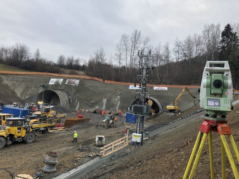
Road and Railway Construction: Precision in Every Kilometer
We support the construction of highways, expressways, and the modernization of main railway lines. Our teams utilize 3D machine control systems and precise GNSS measurements, allowing for the optimization of earthworks and volume calculations.
Roads: Setting out road axes and engineering structures (bridges, viaducts), earthwork volume measurements, and monitoring of embankment settlements.
Railways: High-precision track measurements, setting out turnouts, supporting traction construction, and as-built surveying in accordance with national railway standards (PKP PLK).
Pipelines and Transmission Mains (Gas, Water, Fuels)
The execution of long-distance pipelines requires strict adherence to design specifications and precise surveying of welds and pipe placement in the trench before backfilling.
Pipeline Surveying: Routing transmission lines, supporting horizontal directional drilling (HDD), and precisely mapping clashes with existing underground infrastructure.
Data Security: For pipelines of strategic importance (critical infrastructure), we provide services under strict classified information protection protocols.
Power Lines and High-Voltage Transmission Networks
Surveying overhead and underground power lines is an area where we utilize our advanced 3D scanning and photogrammetry technologies.
Power Lines: Measuring cable sag, determining lattice tower locations, and verticality measurements of support structures.
3D Laser Scanning: We create digital models of transmission corridors, enabling precise clearance analysis to tree canopies or buildings, ensuring network operational safety.
WHY CHOOSE GEO COMPANY FOR LINEAR PROJECTS?
9-Branch Logistics: We are close to your investment, regardless of whether it runs through Lesser Poland, Masovia, or Pomerania.
UAV Technology: We use drones for rapid progress monitoring over long stretches of roads and railways.
Digital Document Workflow: All field data is transferred to our CAD systems in real-time, allowing for an immediate reaction from our engineers.
Frequently asked questions
In linear projects, an error in one section impacts the entire route. Precise surveying is not just about setting out axes, but primarily about earthwork management (optimizing soil transport costs) and settlement monitoring. Correct measurements prevent future road surface cracking and track deformations, directly translating into infrastructure safety and durability.
For projects spanning tens of kilometers, drones (photogrammetry) and 3D laser scanning are unmatched. They allow for rapid terrain surveying, precise mapping of clashes with existing underground utilities, and power line sag measurements without the need to halt energy transmission. As a result, engineers receive a complete digital model of the route in record time.
Zarządzaj zgodą
Aby zapewnić jak najlepsze wrażenia, korzystamy z technologii, takich jak pliki cookie, do przechowywania i/lub uzyskiwania dostępu do informacji o urządzeniu. Zgoda na te technologie pozwoli nam przetwarzać dane, takie jak zachowanie podczas przeglądania lub unikalne identyfikatory na tej stronie. Brak wyrażenia zgody lub wycofanie zgody może niekorzystnie wpłynąć na niektóre cechy i funkcje.
Funkcjonalne
Always active
Przechowywanie lub dostęp do danych technicznych jest ściśle konieczny do uzasadnionego celu umożliwienia korzystania z konkretnej usługi wyraźnie żądanej przez subskrybenta lub użytkownika, lub wyłącznie w celu przeprowadzenia transmisji komunikatu przez sieć łączności elektronicznej.
Preferencje
Przechowywanie lub dostęp techniczny jest niezbędny do uzasadnionego celu przechowywania preferencji, o które nie prosi subskrybent lub użytkownik.
Statystyka
Przechowywanie techniczne lub dostęp, który jest używany wyłącznie do celów statystycznych.Przechowywanie techniczne lub dostęp, który jest używany wyłącznie do anonimowych celów statystycznych. Bez wezwania do sądu, dobrowolnego podporządkowania się dostawcy usług internetowych lub dodatkowych zapisów od strony trzeciej, informacje przechowywane lub pobierane wyłącznie w tym celu zwykle nie mogą być wykorzystywane do identyfikacji użytkownika.
Marketing
Przechowywanie lub dostęp techniczny jest wymagany do tworzenia profili użytkowników w celu wysyłania reklam lub śledzenia użytkownika na stronie internetowej lub na kilku stronach internetowych w podobnych celach marketingowych.